

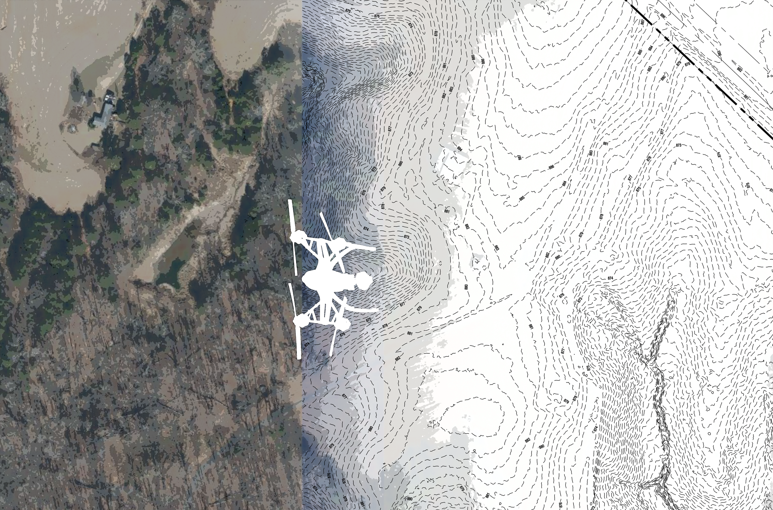
Aerial Imagery with Survey Data
Integrate drone-captured aerial imagery with survey data for advanced site analysis, topographic modeling, and design verification.
Geospatial (LIDAR)
Drone photography
NASCO certified CCTV sewer inspection
Integrate drone-captured aerial imagery with survey data for advanced site analysis, topographic modeling, and design verification.
Geospatial (LIDAR)
Drone photography
NASCO certified CCTV sewer inspection